GEOSPATIAL INTELLIGENCE TECHNOLOGY FOR Precision Agriculture
Maximising Crop Yields & Profits: Revolutionise Farming
Background - Precision Agriculture
An approach that aims to improve efficiency, sustainability and profitability by optimising resources and reducing wastage, using the principle “What gets measured, gets managed.”
An efficient fertiliser & pesticide programme is crucial in agriculture. The effectiveness of a programme would have to be measured for it to be analysed and improved. Nutrient deficiency or crop diseases can be identified using the Trinity F90+ paired with RGB and multispectral cameras. This provides agricultural businesses valuable insights into the health status of their crops, which are useful in helping them design an efficient programme.
Utilising Geospatial Intelligence Technology
There are essentially 3 things that require attention when growing crops; pests, diseases and nutrients.
They can be monitored using geospatial intelligence technology and AECA’s aerial services solutions.
Disadvantages of traditional methods in Precision Agriculture
Time-consuming
LOWER-CROP YIELDS
LIMITED SPATIAL RESOLUTION
LIMITED SCALABILITY

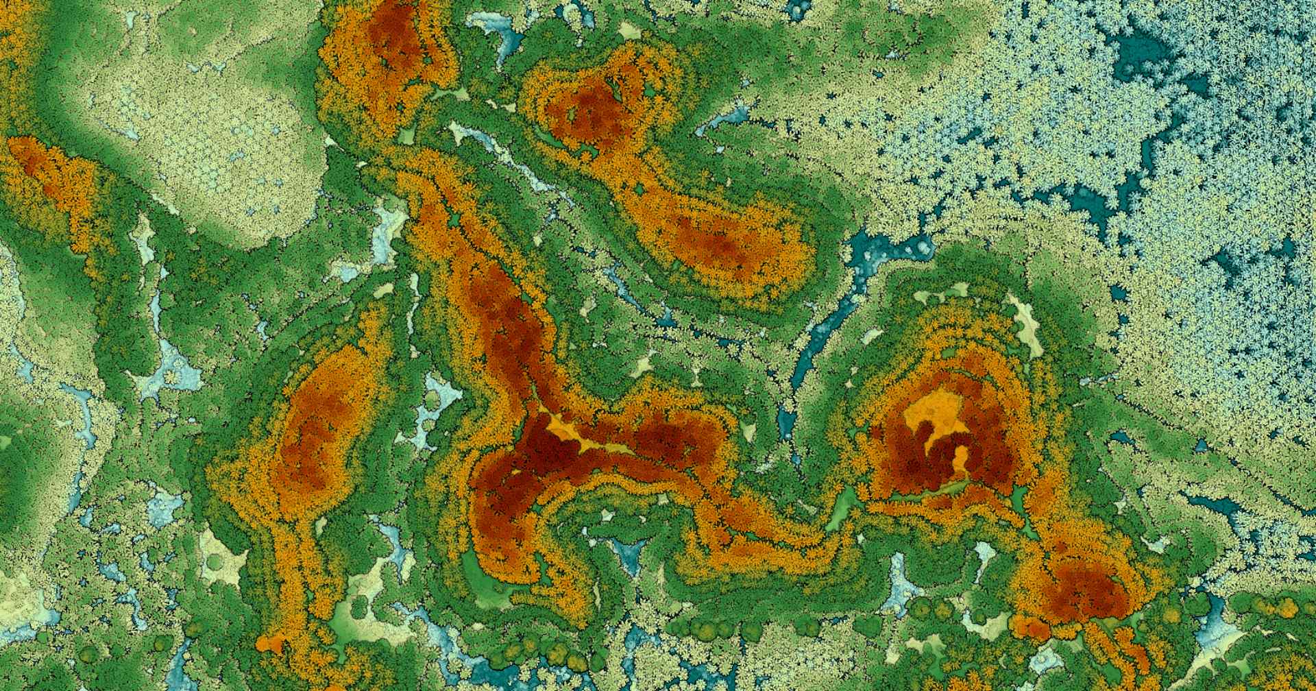
Plant Health Analysis
Our multispectral camera provides our clients with superior data and results that are not possible with RGB cameras alone.
Data Produced: NDVI, OSAVI, SAVI
Benefits
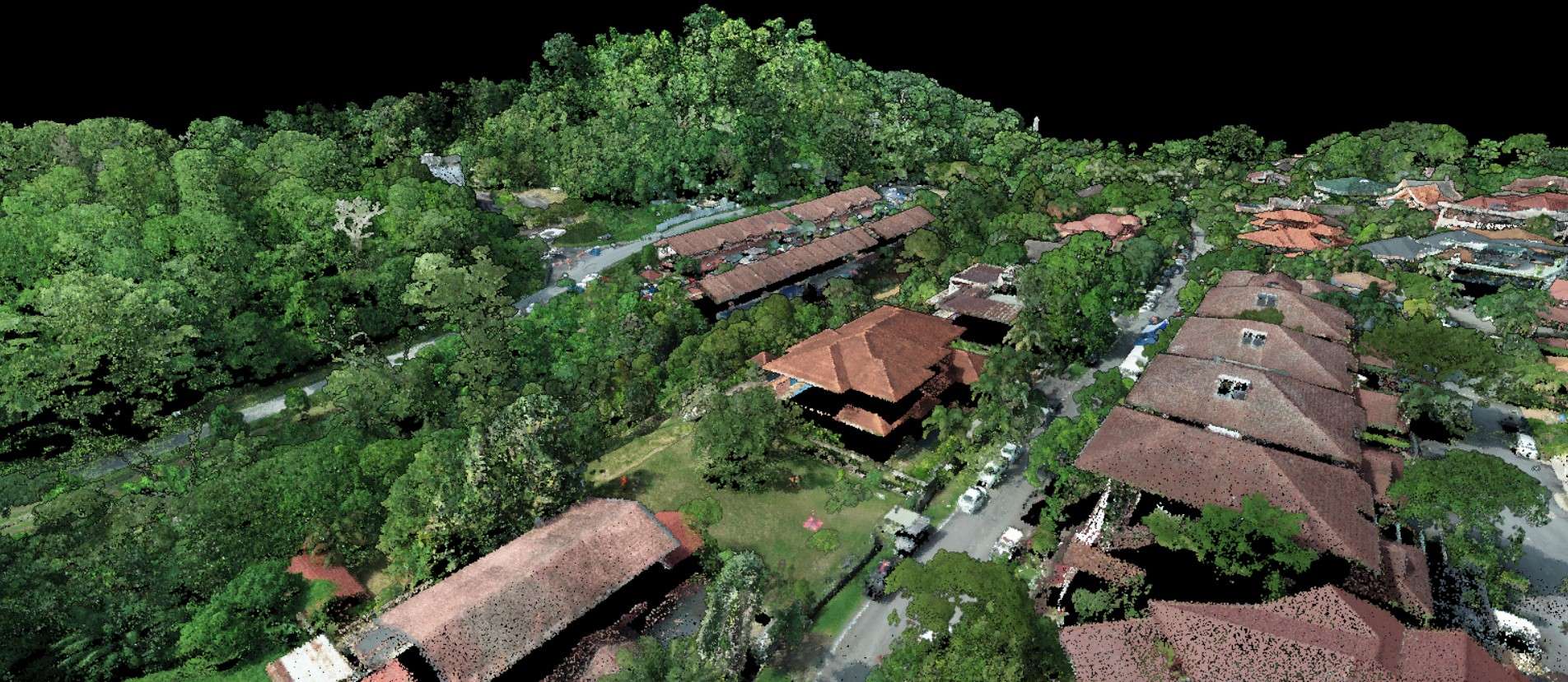
Plantation Management
With the Trinity F90+ drone and Qube 240 LiDAR sensor, AECA Solutions is able to provide data beyond what RGB cameras can provide, due to their vertical take-off and landing ability and terrain follow feature respectively.
The remote sensing capability of the survey-grade LiDAR also makes it possible to penetrate canopies of vegetation and dense forest.
Data Produced: Stand-per-hectare / Density &
Infrastructure / land use map, design map
Benefits
Utilising Geospatial Intelligence Technology
Mapping and Visualisation
Data collection and analysis
Navigation and location
Monitoring and assessment
Has the potential to improve farming efficiency, reduce costs, and increase yields, while also promoting more sustainable agricultural practices.
AECA Can Help You to Obtain Meaningful Data with These Easy Steps
How Aeca adds value in Precision Agriculture
Capture, Process and Analyse Data.”

Capture Data
VTOL Drones
Our Vertical Take Off and Landing (VTOL) drones are capable of covering large areas of up to 10 hectares within 1 hour of flight time.
This gives you as much coverage as an airplane without the extremely high costs, but for a longer duration per flight than a quadcopter, reducing number of flights required for a job.
High-Accuracy Sensors
Using powerful, high resolution cameras, we are able to capture sharper images, better that any consumer-grade cameras designed for cinematography.
Process Data
Just as importantly, AECA has the right hardware and software with the capability and capacity to translate raw data into actionable outputs.
The ability to capture data alone is not sufficient to obtain useful results.
Without powerful, high-speed processors with massive storage space, the data would just be that, data.

Analyse Data
A successful data acquisition or survey should be able to tell you what you should be doing next.
Picking which results to use for your intended purpose can be overwhelming.
AECA has the experience and expertise to help you analyse the results and determine the next courses of action to either save your business time and money, improve efficiency or increase profitability.
The best outcome would be where all of the above are achieved at once.
PAst Projects

Precision Agriculture - Aerial Multispectral Mapping & Monitoring
FAQs
Geospatial Intelligence Technology for Precision Agriculture is the use of advanced geospatial technologies, including remote sensing, geographic information systems (GIS), and precision agriculture tools, to collect and analyse data for precision agriculture applications.
It can provide accurate, efficient, and cost-effective solutions for precision agriculture applications. This technology can also enable the collection and analysis of large amounts of data, allowing for better decision-making and planning.
It is used in a variety of applications, including crop mapping, yield prediction, irrigation management, nutrient management, and pest management. This technology can also be used to optimise the use of agricultural inputs, such as water and fertiliser, and to reduce the environmental impact of agricultural activities.
Geospatial Intelligence Technology for Precision Agriculture can be used to collect and analyse a wide range of geospatial data, including satellite imagery, aerial photography, LiDAR data, GPS data, and other types of remote sensing data.
Geospatial Intelligence Technology for Precision Agriculture can be used to improve crop yields and reduce costs by enabling better decision-making regarding planting, irrigation, nutrient management, and pest control. This technology can also help farmers optimise the use of agricultural inputs and reduce waste.
We Do it for you
(Engage our services)
Tell us about your data needs and sit back while we acquire them for you.
No investment of assets required.
Do it Yourself