Bioeconomy Corporation & Integrated Pest Management (IPM)
Precision Agriculture - Aerial Multispectral Mapping & Monitoring
-
Sungai Besar, Sabak Bernam, Selangor, Malaysia
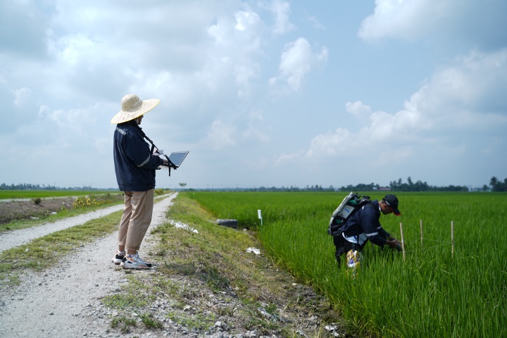
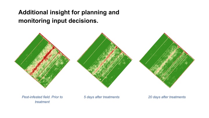
Data collection was carried out to monitor growth, diseases, and pest attacks in order to plan the spatial and temporal distribution of resources. Aside from aerial monitoring, ground checks were performed with a spectro-radiometer to calibrate, interpret, and analyse the aerial data. The crop condition was determined using the stress analysis method, which identifies the location where treatment is required. As with all monitoring, improvements are best tracked when it is done at scheduled intervals. Temporal data shows that the paddy crops recovered and had a higher chlorophyll content after being treated with pesticide and fertiliser.
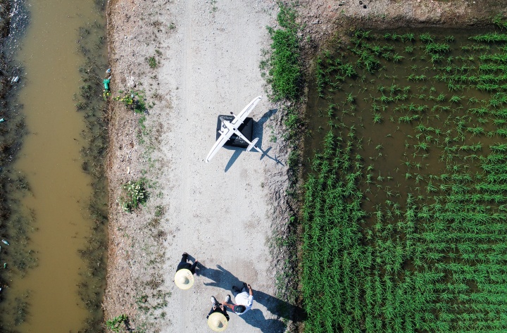
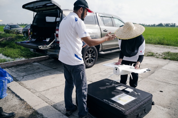
| UAV Type | Trinity F90+ |
| Flight Altitude | 120 m AGL |
| Flight Time | 37 minutes |
| Mission Size | 61.1 hectare / 0.611 sq km |
| Wind | 3 m/s |
| Temperature | 38 degrees Celsius |
| Payload | Double Payloads (MicaSense RedEdge-MX + Sony UMC R10-C) |
| Resolution | MicaSense RedEdge-MX = 8.33 cm / 3.28 inch Sony UMC R10-C = 3.19 cm / 3.22 inch |
| Image count | MicaSense RedEdge-MX = 5775 Sony UMC R10-C = 1151 |
| Overlap | Side 75% Forward 70% |

Transform your business with accurate and actionable insights
Schedule A Demo