GEOSPATIAL INTELLIGENCE TECHNOLOGY FOR Environmental Monitoring

Protecting Our Planet with Cutting-Edge Geospatial Technology

Geospatial technology is playing an increasingly important role in environmental monitoring, enabling us to gather and analyse data about the earth's natural systems with greater accuracy and efficiency than ever before. By leveraging advanced tools such as remote sensing, GIS, and machine learning, environmental scientists and policymakers can monitor changes in the environment in real-time and make informed decisions about how to protect our planet.

Background - Environmental Monitoring

In the past, environmental monitoring was often done through manual observations and sampling, which could be time-consuming and costly. Data was limited and often imprecise, making it difficult to make informed decisions about how to manage and protect our natural resources.

Disadvantages of traditional methods in Environmental Monitoring

Cost more man hours

Manual Sampling

No real-time monitoring

Limited spatial coverage

However, with the introduction of geospatial technology, we now have access to more advanced tools and data sources that enable us to monitor changes in the environment with greater accuracy and efficiency, leading to better decision-making and ultimately a healthier planet.
1

Water Quality & Algae Monitoring

Early detection of the changes in water quality and harmful algal blooms could prevent potential health risks. Through aerial monitoring, high-resolution data of water bodies could be acquired at any time to support the evaluation of environmental issues.

Data Produced: NDTI, NDVI, GNDVI, NDWI, RGB

Benefits

Reduce risk of falling into contaminated water during sampling
Safer during wilderness exploration
Faster decision-making
2

Wildfire Prevention

Forest fires have become quite common in Malaysia, requiring costly crop replantation. Malaysia’s hot and windy climate makes it easier for forest fires to spread wildly and quickly, destroying forest reserves. Wildfire monitoring using high-resolution aerial images can help detect hotspots to prevent wildfires.

Data Produced: Thermal and RGB

Benefits

Highly accurate measurements
Does not require trekking
Covers larger areas
4

Coastal & Coral Monitoring

Coastal areas are ever changing due to urban development, greenhouse emissions and climate change.

There are many things to consider to maintain a healthy coastal ecosystem such as tracking contaminants in the water and surveying the coastline.

Data Produced: NDTI, NDVI, GNDVI, NDWI, RGB & Aerosol indices.

Benefits

Enhances spatial coverage
Real-time monitoring

Utilising Geospatial Intelligence Technology

Geospatial Intelligence Technology is a valuable tool for Environmental Monitoring, providing valuable insights into the Earth’s natural resources, ecosystems, and environmental changes.

Mapping and Visualisation

Create detailed maps and visualisations of an environment; helps monitor changes in environmental conditions, assess the impact of human activities on natural resources, and identify areas of concern or potential environmental risks.

Data collection and analysis

Collect and analyse large and complex geospatial data sets of an environment to help detect changes in land cover, monitor wildlife habitats, assess the health of ecosystems, and identify environmental hotspots that require attention.

ENVIRONMENTAL MODELING AND PREDICTION

Facilitate the development of environmental models and prediction tools to simulate and predict the behavior of natural systems, such as weather patterns, ocean currents, and ecosystem dynamics. Helps forecast the spread of pollutants, predict the impact of climate change on natural resources, and support decision-making for environmental management and planning.

Monitoring and assessment

Monitor and assess changes to evaluate the potential environmental impacts of human activities. Helps inform decision-makers about the best strategies to mitigate and manage those impacts.

AECA Can Help You Obtain Meaningful Data With These Easy Steps

Determine the scope, and points of interest
Select the appropriate drone, cameras and sensors for your application
Obtain necessary permits and approvals
Plan the data collection
Collect data
Process and analyse the data
Monitor the changes in data

How Aeca adds value in Environmental Monitoring

“AECA can help your business in 3 easy steps:
Capture, Process and Analyse Data.”
Step 1: Capture
Step 2: Process
Step 3: Analyse
STEP 1 - CAPTURE

Capture Data

Utilising the latest technology in drones and sensors, we are able to acquire more data in less time.

VTOL Drones
Our Vertical Take Off and Landing (VTOL) drones are capable of covering large areas of up to 10 hectares within 1 hour of flight time.

This gives you as much coverage as an airplane without the extremely high costs, but for a longer duration per flight than a quadcopter, reducing number of flights required for a job.

High-Accuracy Sensors
Using powerful, high resolution cameras, we are able to capture sharper images, better that any consumer-grade cameras designed for cinematography.
Learn About Data Capture 
STEP 2 - PROCESS

Process Data

Our surveying engineering team has the knowledge and skill set to process your data in a meaningful way in order to fulfill your objectives.

Just as importantly, AECA has the right hardware and software with the capability and capacity to translate raw data into actionable outputs.

The ability to capture data alone is not sufficient to obtain useful results.

Without powerful, high-speed processors with massive storage space, the data would just be that, data.
Learn About Data Processing
STEP 3 - ANALYSIS

Analyse Data

With a huge amount of data, comes the challenge of knowing what to do with them.

A successful data acquisition or survey should be able to tell you what you should be doing next.

Picking which results to use for your intended purpose can be overwhelming.

AECA has the experience and expertise to help you analyse the results and determine the next courses of action to either save your business time and money, improve efficiency or increase profitability.

The best outcome would be where all of the above are achieved at once.
Learn about Data Analysis

PAst Projects

Past projects by AECA Solutions

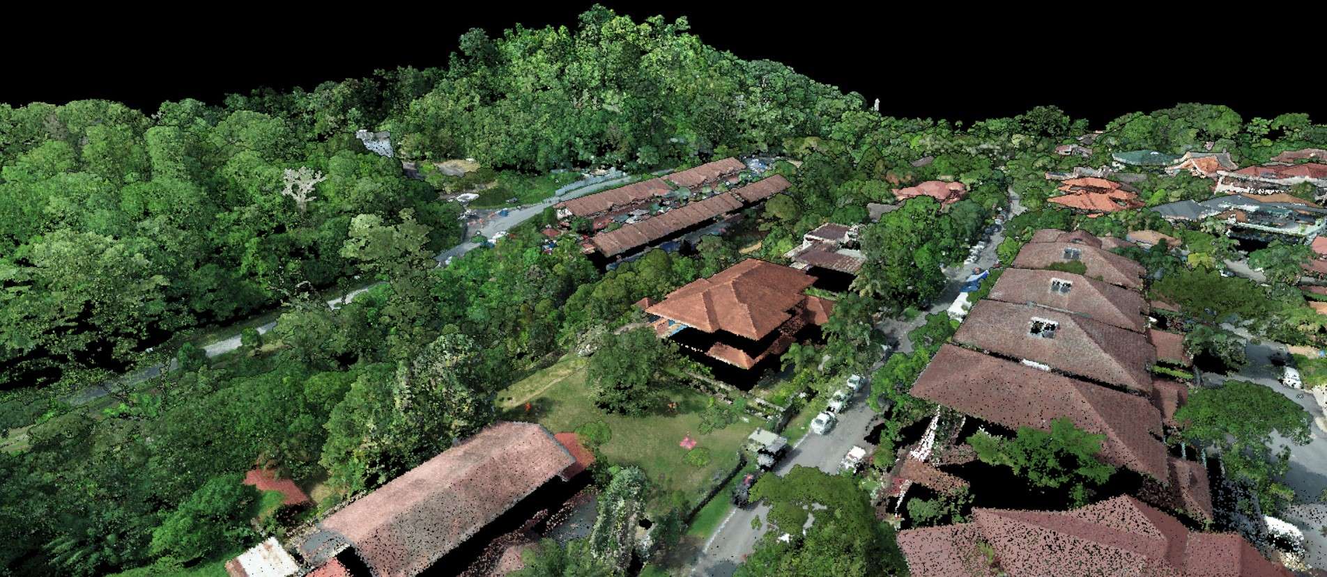
Environmental Monitoring - River Monitoring

Smart Selangor Delivery Unit (SSDU) Innovations Sdn. Bhd.-

Environmental Monitoring - Water Quality Analysis

Lembaga Sumber Air Terengganu (LAUT)-

Environmental Monitoring - River Health Observation

Lembaga Sumber Air Terengganu (LAUT)-

FAQs

What is Geospatial Intelligence Technology for Environmental Monitoring?

Geospatial Intelligence Technology for Environmental Monitoring is the use of advanced geospatial technologies, such as satellite imagery, remote sensing, geographic information systems (GIS), and unmanned aerial vehicles (UAVs), to monitor and analyse environmental conditions.

What are some of the benefits of using Geospatial Intelligence Technology for Environmental Monitoring?

It can provide accurate, real-time data on environmental conditions, enabling better decision-making and planning related to environmental management. This technology can also help to identify areas of concern, monitor changes over time, and support conservation efforts.

What types of environmental data can be collected and analysed using Geospatial Intelligence Technology for Environmental Monitoring?

Geospatial Intelligence Technology for Environmental Monitoring can be used to collect and analyse a wide range of environmental data, including air quality, water quality, land use and land cover, vegetation health, and wildlife populations.

How is Geospatial Intelligence Technology for Environmental Monitoring typically used?

It is used in a variety of applications, including natural resource management, environmental impact assessment, disaster response, and climate change monitoring. This technology can also be used to monitor the effects of human activities on the environment, such as deforestation, urbanization, and mining.

How can Geospatial Intelligence Technology for Environmental Monitoring be used to improve environmental management and conservation efforts?

Geospatial Intelligence Technology for Environmental Monitoring can be used to improve environmental management and conservation efforts by providing real-time data on environmental conditions, enabling better decision-making and planning, and supporting targeted conservation efforts. This technology can also help to identify areas of concern, monitor changes over time, and support efforts to address environmental challenges.

We Do it for you

(Engage our services)

Let us do it for you.
Tell us about your data needs and sit back while we acquire them for you.
No investment of assets required.

Do it Yourself

(Buy Our products)

For frequent data capturing, processing and analysis, reduce cost of operation and starting geo data teams.

Transform your business with accurate and actionable insights

Schedule A Demo
chevron-right