GEOSPATIAL INTELLIGENCE TECHNOLOGY FOR Land Surveying & 3D Mapping
Upgrade Your Drone AND Your Coverage:
Boost Precision and Efficiency Now
With precise data and real-time maps, it streamlines the process for greater accuracy and efficiency. Upgrade your surveying practices now.
Background - Land Surveying & 3D Mapping
Disadvantages of traditional methods in Land Surveying & 3d mapping
Labor-intensive
Data-inaccuracies
Weather-dependent
Limited reach

Aerial survey and mapping
Benefits

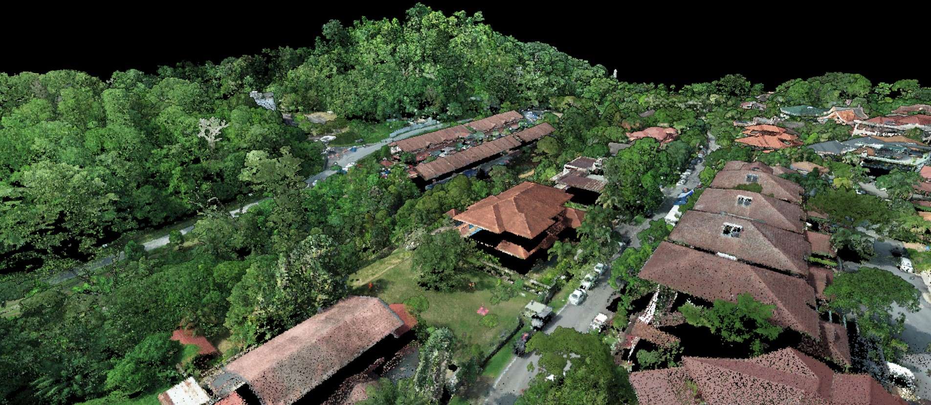
INFRASTRUCTURE ASSET MANAGEMENT
Using aerial and mobile LiDAR, AECA is able to produce 3D models of buildings, create an inventory database as well as detect defects in assets.
Data Produced: Survey-grade high-density LiDAR point clouds, surface models, Hydrolysis and geomorphology analysis
Benefits
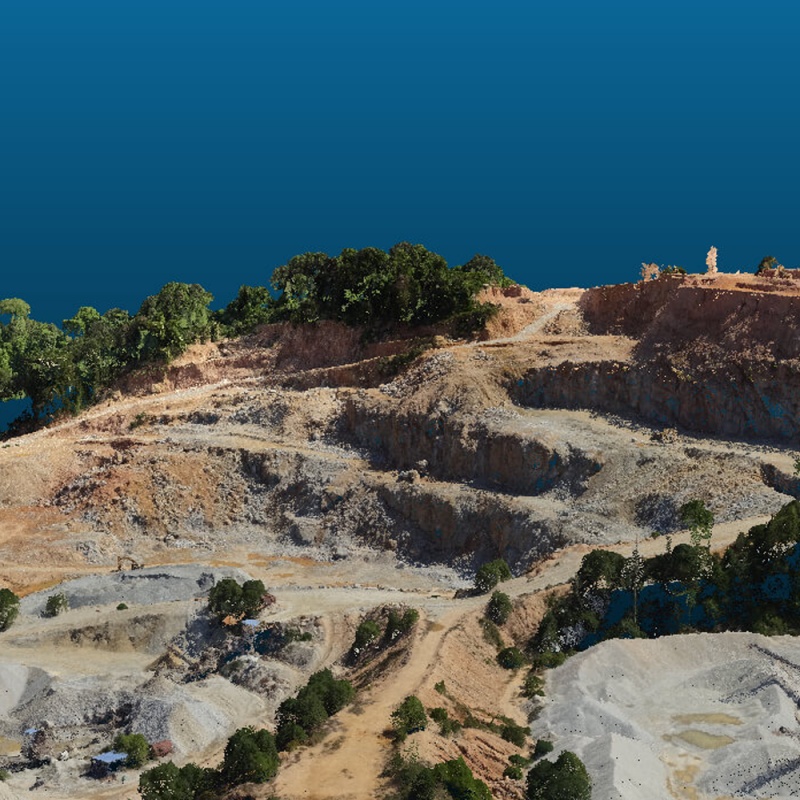
Quarry Stockpile Calculation
This is helpful for businesses in the mining industry to determine the amount of materials available for sale or use, estimate the size of equipment needed to move the materials, and ensure compliance with regulations and safety standards.
Data Produced: Stockpile Volume
Benefits
Utilising Geospatial Intelligence Technology
Mapping and Visualisation
Data collection and analysis
Navigation and location
Monitoring and assessment
AECA Can Help You Obtain Meaningful Data With These Easy Steps
How Aeca adds value in Land Surveying & 3D Mapping
Capture, Process and Analyse Data.”

Capture Data
VTOL Drones
Our Vertical Take Off and Landing (VTOL) drones are capable of covering large areas of up to 10 hectares within 1 hour of flight time.
This gives you as much coverage as an airplane without the extremely high costs, but for a longer duration per flight than a quadcopter, reducing number of flights required for a job.
High-Accuracy Sensors
Using powerful, high resolution cameras, we are able to capture sharper images, better that any consumer-grade cameras designed for cinematography.
Process Data
Just as importantly, AECA has the right hardware and software with the capability and capacity to translate raw data into actionable outputs.
The ability to capture data alone is not sufficient to obtain useful results.
Without powerful, high-speed processors with massive storage space, the data would just be that, data.

Analyse Data
A successful data acquisition or survey should be able to tell you what you should be doing next.
Picking which results to use for your intended purpose can be overwhelming.
AECA has the experience and expertise to help you analyse the results and determine the next courses of action to either save your business time and money, improve efficiency or increase profitability.
The best outcome would be where all of the above are achieved at once.
PAst Projects

FAQs
Geospatial Intelligence Technology for Land Surveying and 3D Mapping is the use of advanced geospatial technologies, such as satellite imagery, laser scanning, and aerial photography, to create detailed and accurate maps and models of the Earth's surface and terrain.
It can provide accurate and detailed data on land use, topography, and infrastructure, enabling better decision-making and planning related to urban development, environmental conservation, and disaster response. This technology can also be used to create 3D models of buildings and infrastructure for design and engineering purposes.
It can be used to collect and analyse a wide range of data, including terrain elevation, land use and land cover, infrastructure location and condition, and natural resource distribution.
Geospatial Intelligence Technology for Land Survey and 3D Mapping is used in a variety of applications, including urban planning, environmental conservation, disaster response, and engineering design. This technology can also be used to monitor changes in the Earth's surface over time, such as land use and vegetation cover.
It can be used to improve urban planning and infrastructure development by providing accurate and detailed data on land use, topography, and infrastructure. This technology can enable better decision-making and planning related to urban development and infrastructure investment.
Geospatial Intelligence Technology for Land Surveying and 3D Mapping is used by a wide range of organizations and institutions, including government agencies responsible for urban planning and infrastructure development, engineering firms, and environmental organizations. This technology is also used in industries such as mining and oil and gas exploration.
We Do it for you
(Engage our services)
Tell us about your data needs and sit back while we acquire them for you.
No investment of assets required.
Do it Yourself