GEOSPATIAL INTELLIGENCE TECHNOLOGY FOR Construction & Infrastructure

Reduce Wastage, Monitor Progress Using Latest Geospatial Technology

Geospatial technology is transforming the construction and infrastructure industries, providing developers and planners with advanced tools to reduce wastage and improve project monitoring.

Background - Construction & Infrastructure

In the past, construction and infrastructure projects were often managed through manual observation and measurement, which could be time-consuming and imprecise. Project managers would rely on paper maps and blueprints, and would often have to physically inspect the site to monitor progress. This method was prone to human error and could lead to costly mistakes and delays.

Disadvantages of traditional methods in Construction & Infrastructure

Cost more man hours

Imprecise Measurements

Reliance on Paper Maps

Prone to Human Error
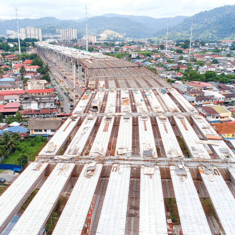
With the introduction of geospatial technology, however, developers and planners can now leverage cutting-edge tools and data sources to manage projects with greater precision and efficiency, reducing wastage and ultimately saving time, resources and money.
1

Progress Monitoring

The construction and infrastructure sector have switched from conventional methods of surveying and security inspections to advanced, highly accurate progress monitoring via UAVs.

Data Produced: RGB & LiDAR

Benefits

Long-term monitoring of larger areas
Variable rotors to ensure velocity as per the given situations
Long duration work is shown in a quick review
Real-time and accurate recording of information
Bigger coverage area
2

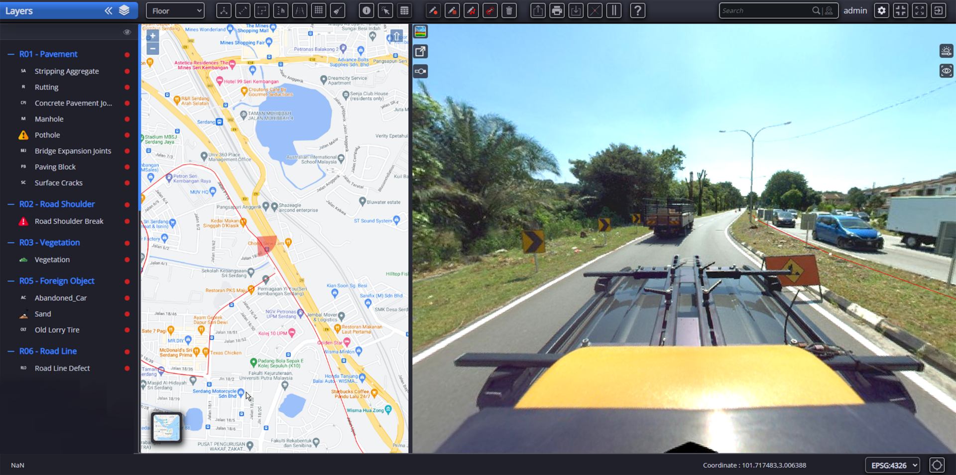
Infrastructure And Asset Inventory

AECA Solutions has a reputation for offering and deploying drones that generate comprehensive and accurate databases. With the help of specialised equipment, users can monitor data with high point density for planning and remote measurement.

Data Produced: RGB, LiDAR, 360 degrees

Benefits

Accurate asset databases
Observations from a higher altitude
Remote planning and measurement
Comprehensive information about the infrastructure and assets
3

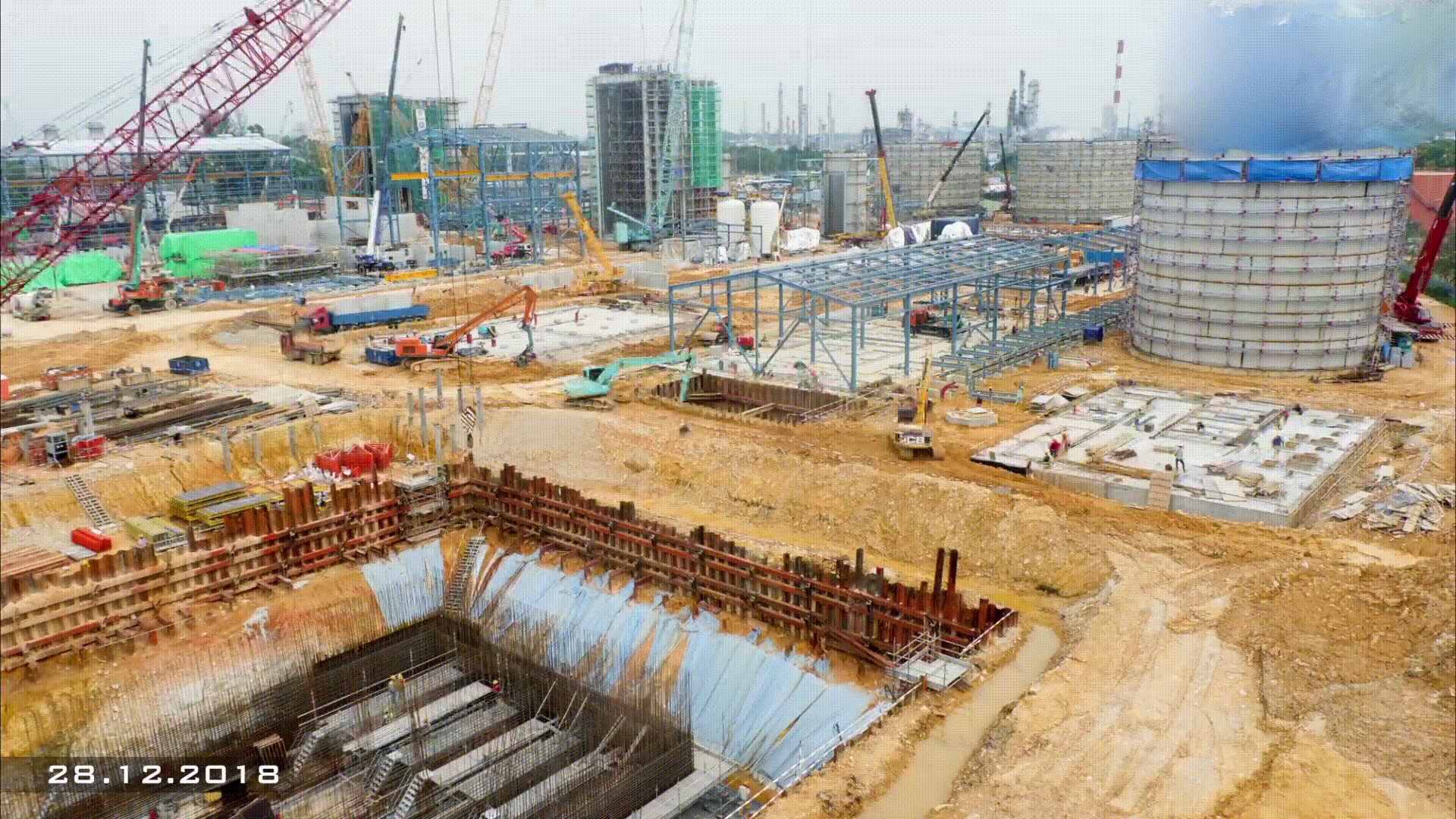
Time-Lapse Monitoring

Time-lapse monitoring is very important to track the progress of projects in real-time, providing progress reports through images.

Time-lapse videos show how an area is revitalised by building something new or removing something old and whether it was done efficiently and with consideration to the environment and surroundings.

Utilising construction time-lapse video cameras offers a range of benefits that drive results for your company beyond the duration of your projects.
Data Produced: RGB, Video

Benefits

Long-lasting, quick and easy set up, online monitoring
Reliable industrial-grade equipment
Adds to your marketing assets and sales kit

Utilising Geospatial Intelligence Technology

Geospatial Intelligence Technology is a valuable tool for Construction and Infrastructure, providing professionals in the industry information for better decision-making.

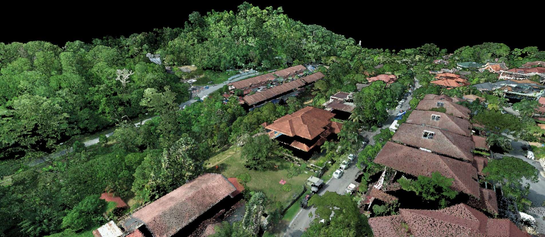
Mapping and Visualisation

Create detailed maps and visualisations of construction sites; helps project managers quickly and accurately collect data on site conditions and existing infrastructure.

Data collection and analysis

Collect and analyse data of construction projects and to select optimal sites for new projects. Geospatial intelligence can help identify the most suitable locations for construction projects, minimising risks and optimising resource allocation.

Navigation and location

Provide location-based information and guidance; helping project managers navigate and find their way to a particular location.

Monitoring and assessment

Monitor and assess changes in a construction site over time; helps assess and mitigate risks by analysing geospatial data on environmental factors, natural hazards, and regulatory requirements. Helps identify potential risks and develop strategies to mitigate them.

AECA Can Help You Obtain Meaningful Data With These Easy Steps

Determine the scope, and points of interest
Select the appropriate drone, cameras and sensors for your application
Obtain necessary permits and approvals
Plan the data collection
Collect data
Process and analyse the data
Monitor the changes in data

How Aeca adds value in Construction & Infrastructure

“AECA can help your business in 3 easy steps:
Capture, Process and Analyse Data.”
Step 1: Capture
Step 2: Process
Step 3: Analyse
STEP 1 - CAPTURE

Capture Data

Utilising the latest technology in drones and sensors, we are able to acquire more data in less time.

VTOL Drones
Our Vertical Take Off and Landing (VTOL) drones are capable of covering large areas of up to 10 hectares within 1 hour of flight time.

This gives you as much coverage as an airplane without the extremely high costs, but for a longer duration per flight than a quadcopter, reducing number of flights required for a job.

High-Accuracy Sensors
Using powerful, high resolution cameras, we are able to capture sharper images, better that any consumer-grade cameras designed for cinematography.
Learn About Data Capture 
STEP 2 - PROCESS

Process Data

Our surveying engineering team has the knowledge and skill set to process your data in a meaningful way in order to fulfill your objectives.

Just as importantly, AECA has the right hardware and software with the capability and capacity to translate raw data into actionable outputs.

The ability to capture data alone is not sufficient to obtain useful results.

Without powerful, high-speed processors with massive storage space, the data would just be that, data.
Learn About Data Processing
STEP 3 - ANALYSIS

Analyse Data

With a huge amount of data, comes the challenge of knowing what to do with them.

A successful data acquisition or survey should be able to tell you what you should be doing next.

Picking which results to use for your intended purpose can be overwhelming.

AECA has the experience and expertise to help you analyse the results and determine the next courses of action to either save your business time and money, improve efficiency or increase profitability.

The best outcome would be where all of the above are achieved at once.
Learn about Data Analysis

PAst Projects

Past projects by AECA Solutions

FAQs

What is Geospatial Intelligence Technology for Construction Infrastructure?

Geospatial Intelligence Technology for Construction Infrastructure is the use of advanced geospatial technologies, including remote sensing, geographic information systems (GIS), and building information modeling (BIM), to collect and analyse data for construction infrastructure projects.

What are some of the benefits of using Geospatial Intelligence Technology for Construction Infrastructure?

It can provide accurate, efficient, and cost-effective solutions for construction infrastructure projects. This technology can also enable the collection and analysis of large amounts of data, allowing for better decision-making and planning, as well as improved safety and risk management.

How is Geospatial Intelligence Technology for Construction Infrastructure typically used?

Geospatial Intelligence Technology for Construction Infrastructure is used in a variety of applications, including site selection, planning and design, construction management, asset management, and risk assessment. This technology can also be used to monitor construction progress and detect potential issues, such as delays or cost overruns.

What types of geospatial data can be collected and analysed using Geospatial Intelligence Technology for Construction Infrastructure?

It can be used to collect and analyse a wide range of geospatial data, including satellite imagery, aerial photography, LiDAR data, GPS data, and other types of remote sensing data. This technology can also be used to integrate data from multiple sources, such as BIM models and sensor networks.

How can Geospatial Intelligence Technology for Construction Infrastructure be used to improve project outcomes?

Geospatial Intelligence Technology for Construction Infrastructure can be used to improve project outcomes by enabling better decision-making regarding site selection, planning and design, construction management, asset management, and risk assessment. This technology can also help to reduce costs, improve safety, and increase efficiency.

We Do it for you

(Engage our services)

Let us do it for you.
Tell us about your data needs and sit back while we acquire them for you.
No investment of assets required.

Do it Yourself

(Buy Our products)

For frequent data capturing, processing and analysis, reduce cost of operation and starting geo data teams.

Transform your business with accurate and actionable insights

Schedule A Demo
chevron-right